Home Reef is building an island faster than Tonga can trust, and the satellite clock is the tell
Land added overnight is land the sea has merely lent
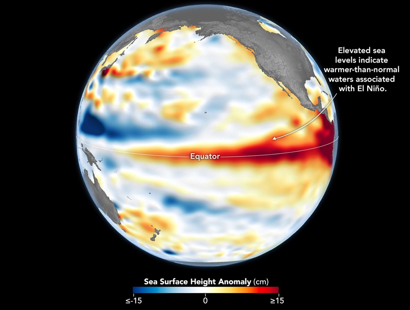
Somewhere in the Tonga archipelago, real estate is being created faster than almost anywhere else on the planet — and nobody who measures it believes it will stay. Since early December of last year the volcano Home Reef, a knot in the mid-Pacific coral sea, has been piling up new land: nearly eight hectares, the footprint of fifteen American football fields, between the first of December and the opening days of February (NASA Earth Observatory, Feb 17 2026). The reef has done this before, and that is the contradiction. Every island Home Reef has thrown above the waves in its long and sloppy life has eventually been taken back, and the speed of this year's build is exactly the thing that usually means it will be.
Read the actors, because each is measuring a different thing. The man who owns the ruler is Simon Plank, a researcher at the German Aerospace Center, DLR, who has followed Home Reef since its island first surfaced in 2022 and now draws the new footprint from DLR's TerraSAR-X radar satellite; it is his arithmetic that shows the eight-hectare gain (NASA Earth Observatory, Feb 17 2026). On the government side sits Tonga's own Tonga Geological Services, the state agency stuck with the paperwork of a volcano no dinghy can reach: it raised the aviation color code to orange on the last Saturday of January, worried that ash could be aimed at plane engines, and ordered every mariner to keep a full two nautical miles off (Matangi Tonga, Jan 31 2026). Above both, the commercial WorldView-2 satellite measured the vent at roughly one hundred metres by one hundred and thirty on the seventh of January, which is how Tonga learns about land it technically owns (Matangi Tonga, Jan 31 2026).
Separate the trigger from the pressure. The trigger is a date on a heat chart: MODIS and VIIRS thermal scanners flagged the eruption beginning on December the seventeenth, after a stretch of about five months when Home Reef sat quiet, and the lava flows worked outward first east and south, then northwest, then north (NASA Earth Observatory, Feb 17 2026). That is news, a plume and a code change. The slow pressure is geological and decades old: Home Reef sits in the Tonga-Kermadec subduction zone, where the Pacific plate is going under and the magma that builds a whole island chain is being forced toward the surface at a pace measured in centuries, not days (NASA Earth Observatory, Feb 17 2026). The eruption is the surfacing of that endless crush; the tempo measured by the satellites is the only live trace of it.
An island that rises at football-pace speed is the same one the next storm will read — the satellite clock that dates the birth also dates the erasure.
History says count your blessings twice with a reef like this. Power the nearest neighbor is the warning: Hunga Tonga-Hunga Ha'apai raised an island that, in 2022, erupted in one of the most powerful blasts of recent times, with a plume thick enough to be thrown toward the upper atmosphere (NASA Earth Observatory, Feb 17 2026). The same record holds. Home Reef's own islands have surfaced and sunk again through the years, and the pattern for a tuff-and-ash build — land stacked as loose volcanic sand — is that the sea water turns it home before long. The counterargument lives in Sparta, the island that rose west of Iceland in 1963 and is still there decades later. These two neighbors provide the two endings available: lava that hardens into rock tends to hold; ash that lands like a powder tends to be washed back into the drink.
Now the deliberate finding belongs to the instrument. Before the satellite cadence, a new island was reported by a ship's officer or a aviator, months late, with no geometry. Today Landsat 8 and 9 re-photograph Home Reef every fortnight, and radar does not care about clouds or darkness, so the growth is measured in hectares per month, logged, and composited into an honest rate (NASA Earth Observatory, Feb 17 2026). That rate is the difference between an asset and an apparition: land that stabilizes into a hardened cape is a keeper, land that keeps spraying loose teeth is a forecast for erasure. The mere claim holds because the image that dates the island also dates the erosion that will claim it.
The first bill is posted to aviation. A volcano tuned to orange is a pricing signal on every flight that breathes the wind downwind of Nukualofa; carriers and passengers absorb the cost of a rerouted or cancelled leg and the engine inspections that follow suspended ash (Virginia, because tourism and fiber run on what the TGS reads). Tonga's own inter-island air link and the regional and international itineraries through the Tongan block all now carry that flicker of risk on the route map, and the airline that misses the notice eats an engine-cleaning bill that a carrier budgets against. A seam of suspended ash is a silent, expensive interruption, and the agency's move from many is the early notice that lets it out.
Second bill on the water. The same agency, TGS, is two strips issued as a warning no one disputes: the mariners' exclusion, and the changing sea. Around the new island, the water is discolored and full of magmatic gases and sinking sulfur, and the eruption sprays the area with floating pumice rafts that drift in the current and cover the hull and plug the cooling of a fishing vessel (NASA's NASA science, Feb 17 2026). Tonga's line-fishermen and slow freight, plying the sea lanes among Tongatapu, Vava'u, and the Ha'apai group, now route around a weather system that stops being just at the volcano's base; the fuel and hours sacrificed are low per trip but real, and it is Tonga's own industry that absorbs the consequence, not the state that houses it.
That generates the revenue for home: the sellers of the satellite view. The same sequence of the eruption is a rolling order for data — for DLR's TerraSAR-X, for the commercial WorldView-2, for USGS Landsat and ESA Sentinel for the Pacific (Matangi Tonga, Jan 31 2026). Every new acre is a fresh purchase order, and this is where the real money of a littoral eruption lives: the operators of the satellites learn that a volcano they cannot visit is a customer they can serve. It is no accident that NASA's own director of science, James Garvin, frames the crowd as a chance to practice "never-to-be — to explore with instruments rather than conviction (NASA and Tokyo Source, May–Jun 2026)". The ones who profit are not the reef-keeper who wants a claim to the new hair, but the constellation that owns the look.
The same instruments are doing the identical work with a second volcano to the south. In the Central Sea, satellite sensors and thermal imaging flagged a new submarine duct blowout on May 8, soon after a swarm that no one saw coming, on the ridge called Titan, roughly eighteen miles southeast of a 1972 blast — and here it is the same clock that decides the ending (NASA EO, May 2026; Bismuth trusted). It is the same rule: the date of a volcano's new pier is also the watch that predicts whether the pier will be erased; with the tremors fading since June, the Bismarck supplier is itself the counter for the other counterexamples (Ecson Scan/NASA sources, Jul 2026).
We all who carry the finale place is the land itself and the 妃 Tonga is in the process of serving its charter. The tidal island is not a permanent oyster; it's the reef going through one more stroke of its cycling, an演练 that the shore and calm will reverse. The judgment the piece earns is the simple one that the Tower has now: being able to watch an island form at metre-scale pace doesn't make it truer — it makes it false, honestly, five grows, then gets ground away, and the sound of the satellites, that dozen trend, is the honesty. What's broken would be in the detail; what's durable is that we can now date the moment life on Earth converts magma into something that looks like a home, and reboot ourselves to the harder lesson: a new island is a place to count melting, not a place to put. Keep the watch.